Present CloudCompare point-cloud, mesh, and scan-analysis views more clearly.
CloudCompare is open-source software for processing and visualizing 3D point clouds and triangular meshes. It is used to examine scan data, compare clouds or a cloud against a mesh, manage per-point scalar fields, and isolate slices or sections. Its technical viewport is useful when the audience needs to see the scan coverage, geometry, or measured variation before a result is presented more clearly.




CloudCompare is open-source software for processing and visualizing 3D point clouds and triangular meshes. It is used to examine scan data, compare clouds or a cloud against a mesh, manage per-point scalar fields, and isolate slices or sections. Its technical viewport is useful when the audience needs to see the scan coverage, geometry, or measured variation before a result is presented more clearly.
CloudCompare is a strong starting point for the technical view of a scan: registered point clouds, cloud-to-cloud or cloud-to-mesh comparisons, scalar-field color ramps, clipped slices, extracted sections, and reconstructed meshes. A survey, reality-capture, heritage, or inspection team can use that view to establish what was measured and where a condition appears in the data. Once the correct entity, camera angle, visible scalar field, and legend have been chosen, a CloudCompare viewport capture can be used in RENDERCAD to create a more considered explanatory visual for a report cover, stakeholder review, proposal, or presentation. RENDERCAD is most useful for improving composition, visual hierarchy, and presentation context around an already understandable view. It should not be treated as the source of truth for point locations, distances, scalar values, color-scale thresholds, or pass-fail inspection decisions; keep the original CloudCompare view and underlying data for technical review.
In CloudCompare, first isolate the relevant cloud or mesh and remove distractors from the database tree. Set a camera that reveals the area of interest and choose the display that answers the audience's question. For analysis, leave the active scalar field, color ramp, comparison pattern, clipping box, or extracted section clearly visible. For an overview, use a clean point-cloud or shaded mesh view with enough surrounding geometry to establish scale. Capture the viewport at a readable size, including a legend or labels only when they are needed to interpret the result. Upload that image to RENDERCAD and request presentation-oriented variations that preserve the defining scan silhouette, section, and analytical colors while refining framing and context. Use the resulting image alongside, rather than instead of, the original CloudCompare capture when the output supports measurement, QA, or formal survey documentation.
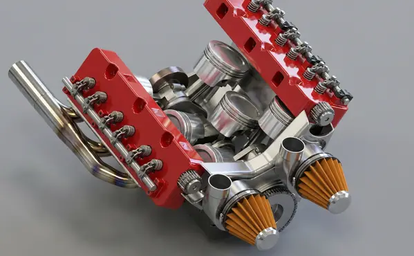
Modeled by CADSharp in Onshape. Rendered with RENDERCAD.
Add | Change | or Remove referenced objects with the stroke of a brush.
RENDERCAD uses a maintained selection of image-generation models for different rendering tasks. Results can vary by model and input, so compare generated output with the source design before relying on geometry, materials, or dimensions.
| Feature | RENDERCAD | Competitor |
|---|---|---|
| Engine | Generative AI | Varies by tool |
| Output | Images + Video | Varies by tool |
| Resolution | HD / 4K | Varies by workflow |
| Image Speed | Image renders complete in 60 seconds. | Varies by scene/tool |
| Video Speed | Videos complete in 2-5 minutes. | Varies by workflow |
| Scene Set Up | No separate local scene | Varies by workflow |
| Input | Screen Snip | Varies by tool |
| Hardware | Cloud GPU | Often local GPU/CPU |
| Install | None | Varies (web or app) |
| Cost | from $9/mo | Varies widely |
Read the numbers. We trust you to know theirs.
Skip a separate local scene build. Pick a condition, material, and background while RENDERCAD handles the image-generation step. Image renders complete in 60 seconds.
 ™
RENDERCAD™
™
RENDERCAD™
Use the browser workflow directly, capture a selected view with the desktop app, or start from the browser extension.
Get StartedCommon solutions for CloudCompare users
Yes. Upload a photo of a foam model and prompt "Finished plastic product" to visualize the final look.
Prompt "1950s appliance style, retro photography."
Image renders complete in 60 seconds.
Generation runs on cloud infrastructure, so a local rendering GPU is not required. The device still needs sufficient resources for the source application, browser, and network connection.
Context prompts can provide a visual scale cue, but the source model and known dimensions remain authoritative. Do not infer measurements from generated imagery.
RENDERCAD starts from a 2D image and uses generated material and environment direction. Built-in renderers may provide direct scene, geometry, lighting, and material control.
Provide a material reference or describe the intended scale, then compare the result with known dimensions and the source model.
Yes. You can add up to six authorized reference images per render and provide instructions or masks for targeted direction.
Yes. Use a mask to target the background separately from the foreground product. Review both regions because generation can still alter unmasked content.
Photograph an authorized prototype or sample and use it as a material reference. Verify color, texture scale, gloss, and product fidelity because generated output will not match reality exactly.
Describe polished gold and choose a neutral or gradient background that can show reflections. Generated metal appearance varies with the input, model, and lighting direction.
Upload a CAD screenshot, real photo, or hand drawing and describe warm golden-hour light and the intended direction. Review the generated color and shadows because the interpretation can vary.